New Vertabelo Academy Course: Learn How to Work with Spatial Data with PostGIS


Managing spatial data is useful but challenging – learn how to do it in PostgreSQL with our latest course.
At Vertabelo Academy, we believe that learning by doing is the best way to master a new skill. So we’re excited to introduce a new, easy-to-understand course in PostGIS.
PostGIS is a spatial extension for object-relational PostgreSQL databases. It stores geographical data objects, allowing SQL queries to process them as they would other pieces of data. PostGIS makes spatial data easier and more intuitive to manage and use.
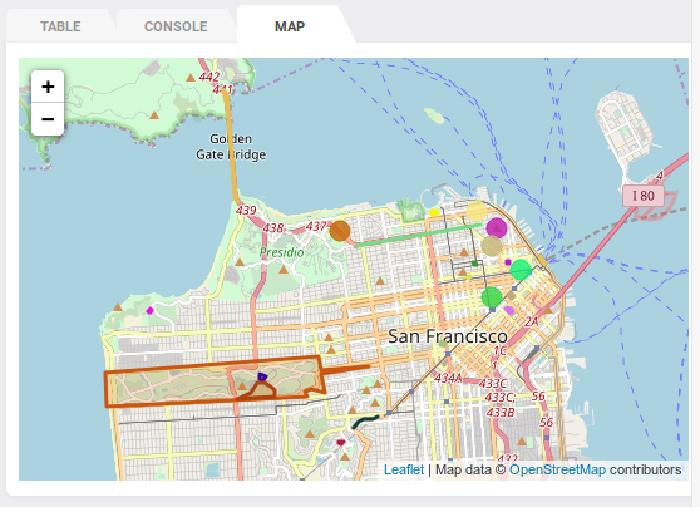
Are you familiar with Google Maps, Uber, or Parking Panda? These are only a few location-aware mobile applications. Whether you know it or not, you benefit from geodatabases every day. They are commonly used for urban planning, transportation guidance, and remote sensing – basically anything with latitudinal and longitudal points. The core elements of the spatial database are points, linestrings, and polygons. When combined, they represent an actual location.
With Vertabelo Academy’s fully interactive app-based learning, you’ll learn how to store and query geometric data. The course should take about 12 hours to complete. All you need is a browser and a working knowledge of SQL Basics. And we dare say this is the only interactive PostGIS course on the web!
As you progress through the course, you’ll see real-life examples and scenarios. Hints are available in many of the exercises, and you can always talk to the Vertabelo Academy community via the Disqus tab. Or simply drop us a line at academy@vertabelo.com.
Ready to learn how to use SQL on spatial data? Try our PostGIS course for free!